Enhance Your Photos with Geotag Map Camera
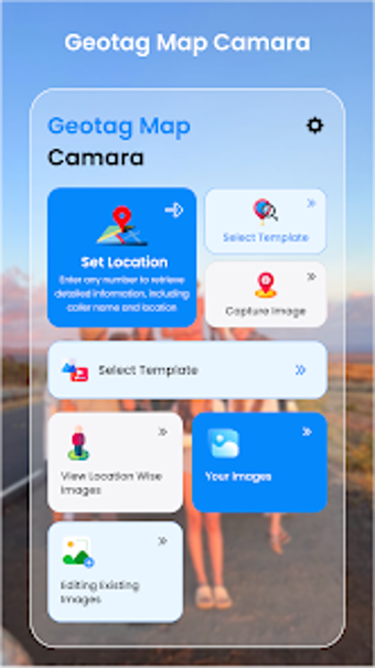
Geotag Map Camera is a free multimedia application designed for Android devices that elevates photography by integrating geolocation features. Users can add a variety of timestamp templates to their photos, along with live map visuals, longitude, and altitude information. This app is particularly useful for those who want to document their travels or outdoor activities with precise location data.
The application allows users to customize their photos with multiple timestamp and date options, ensuring that each image captures the moment accurately. Additionally, it provides GPS coordinates and a visual representation of the photo's location on a map, making it easier to remember where each photo was taken. With its user-friendly interface and essential features, Geotag Map Camera is an excellent choice for photography enthusiasts looking to enhance their images with geographical context.